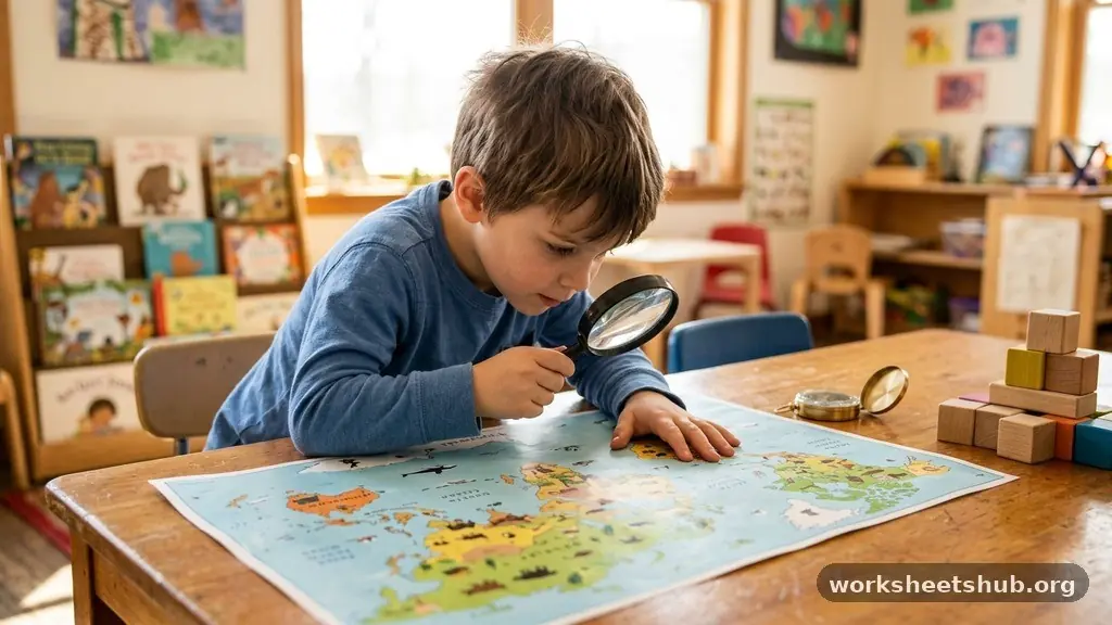
Engaging in fun geography activities for introducing children to maps and places transforms abstract concepts into tangible adventures. By moving beyond rote memorization, parents and educators can cultivate a deep sense of spatial awareness and curiosity about the wider world. Whether you are using a simple compass rose in the backyard or exploring complex digital tools, these hands-on methods build the foundation for lifelong geographic literacy.
This approach helps young learners understand their position in the world while sparking an interest in the diverse cultures, landforms, and environments that define our planet. Let’s look at how you can turn map reading into a captivating daily habit for your family.
The Basics of Map Literacy
The most effective way to start is by demystifying the basic components of any map. Every child should first learn how to identify a map legend, which serves as the translation key for the symbols they see on the page.
Explain that a blue line might represent a river, while a small black square could indicate a building or a park. Once they grasp the legend, introduce the scale bar to help them understand distance in a real-world context.
Learning to use a compass rose is the next logical step in building spatial awareness. Teach your children the cardinal directions—North, South, East, and West—using a physical compass during a walk around the neighborhood.
You can even create a giant chalk compass on the driveway to make the concept physically interactive. This helps them bridge the gap between a flat piece of paper and the three-dimensional space they occupy.
Finally, discuss how maps simplify complex reality into manageable information. Show them the difference between a standard road map and a topographic map that highlights elevation changes.
By contrasting these two types, you demonstrate that maps are tools designed for specific purposes. This early exposure to the variety of cartographic styles encourages children to think critically about how information is displayed and interpreted.
Creative Map-Making Projects
Creating custom maps is perhaps the most powerful way to solidify a child’s understanding of their surroundings. Start by asking them to map their bedroom, their house, or even the route from their front door to the local library.
This exercise in mental mapping forces them to observe landmarks, distances, and spatial relationships they might otherwise ignore. Encourage them to use colors and icons to represent different objects, which reinforces the concept of a map legend.
For a more ambitious project, try building a 3D model of a local park or neighborhood. Use materials like cardboard, clay, or recycled household items to represent different landforms and buildings.
This tactile process helps them connect the flat symbols on a paper map to actual physical structures. It also invites them to think about why certain features are placed where they are.
Collaborative map-making teaches children that geography is a shared human experience. Work together on a “treasure map” for the backyard, complete with hidden landmarks and secret paths.
This turns cartography into a game rather than a chore. As they refine their drawings, they naturally begin to consider perspective, scale, and the importance of clear communication in map design.
Geocaching and Real-World Navigation
Geocaching is essentially a high-tech, global scavenger hunt that uses GPS coordinates to lead participants to hidden containers. It is one of the most exciting fun geography activities for introducing children to maps and places because it rewards them with an immediate physical goal.
You can find thousands of caches hidden in public parks, forests, and urban centers worldwide. It is a fantastic way to teach kids how to use coordinates and navigate to specific points on a map.
When you go geocaching, you are teaching your child how to interpret digital map interfaces alongside traditional spatial reasoning. They will need to observe their environment closely to find the hidden caches, which are often tucked away in clever, camouflaged spots.
This activity demands focus, patience, and a keen eye for detail. It also provides a great excuse to explore new parts of your city that you might otherwise never visit.
Safety and respect are core components of this activity. Teach your children the “leave no trace” principle, ensuring that they treat the environment and the caches with care.
You can find more information on how to get started with this global community through the official Geocaching platform. It provides a structured way to introduce kids to the importance of global positioning and responsible exploration.
Understanding the Globe and World Geography
While flat maps are useful, a globe provides the only accurate representation of the Earth’s curvature. Use a globe to teach children about the continents and oceans in a way that respects their actual geographic placement.
Spin the globe and ask them to find their own country, then trace the distance to a place on the opposite side of the world. This helps them visualize the scale of the planet and the vastness of the oceans.
Introduce the concepts of latitude and longitude using the globe’s grid lines. Instead of teaching these as abstract coordinates, frame them as a global address system.
You can play games where you give them a set of coordinates and they race to find the intersection on the globe. This makes the math behind geography feel like a secret code they are learning to crack.
Comparing a globe to a flat map allows for deep conversations about distortion. Explain why Greenland looks massive on some maps but tiny on the globe.
This introduces the idea that all map projections involve trade-offs, a concept that even younger children can grasp with a bit of guidance. It fosters a healthy skepticism and a more nuanced understanding of how we represent the Earth.
Geography Through Literature and Storytelling
Books are a wonderful way to transport children to new places and spark their interest in world geography. Choose adventure novels or travel journals that describe specific landscapes, cultures, and environments in vivid detail.
As you read, keep a map or a globe nearby so they can pinpoint where the story is taking place. This turns reading into an interactive geography lesson.
Non-fiction books about different countries are also excellent resources for building geographic literacy. Look for titles that emphasize the daily lives of children in other parts of the world, including their food, school, and local geography.
This humanizes distant places and makes the study of maps feel more personal. It moves the focus from dry statistics to the vibrant reality of life in different regions.
You can also encourage your children to write their own travel stories based on imaginary trips. Have them draw the maps for these adventures, incorporating the landforms and climate zones they have learned about.
This creative process forces them to apply their geographic knowledge in a meaningful context. It turns the study of geography into a vehicle for their own imagination and self-expression.
Comparative Geography Data
Understanding the diversity of our planet is easier when you can compare different regions side-by-side. Use simple tables to help children organize their observations about different climates, populations, or landforms.
This data-driven approach encourages them to look for patterns and connections between geography and human activity. Below is an example of how you might categorize different environments to compare them easily.
| Region | Primary Landform | Typical Climate | Key Characteristic |
|---|---|---|---|
| Sahara | Desert | Arid/Hot | Minimal rainfall |
| Amazon | Rainforest | Tropical/Humid | High biodiversity |
| Himalayas | Mountains | Alpine/Cold | High elevation |
| Great Plains | Grasslands | Temperate | Fertile soil |
This type of structured comparison helps children see that geography dictates how people live, what they eat, and how they build their homes. When they see that the Sahara is an arid desert while the Amazon is a humid rainforest, they start asking “why.”
That question is the heart of geography. Encouraging them to fill out their own comparison charts for different countries can be a highly engaging project.
Outdoor Exploration and Scavenger Hunts
Getting outside is the most natural way to practice geographic skills. Organize a local scavenger hunt that requires the use of a map to find specific natural features.
You can task your children with finding a hill, a creek, a specific type of tree, or a change in soil type. This forces them to interact with the landscape and observe how it is shaped by natural forces.
Bring a compass and teach them how to orient their map to the north. This simple skill is a fundamental aspect of spatial awareness that is often lost in the age of smartphones.
By relying on manual tools, they develop a deeper appreciation for how explorers and scientists have navigated the world for centuries. It builds confidence and independence in their ability to explore safely.
Keep a nature journal where they can sketch the landmarks they find and mark them on their hand-drawn maps. This bridges the gap between observation and documentation.
It turns a simple walk in the park into a scientific expedition. Over time, they will develop a detailed map of their local area that reflects their personal experiences and discoveries.
The Importance of Geographic Literacy
Geographic literacy is far more than just knowing the names of countries or capital cities. It is about understanding the interconnectedness of our world, from the environment to human society.
When children learn to read maps, they are learning to analyze information, understand spatial patterns, and think critically about the world around them. These skills are essential for navigating life in an increasingly globalized society.
By fostering this interest early, you are giving your children the tools to become informed global citizens. They will be better equipped to understand news reports about international events, climate change, and cultural shifts.
They will also develop a sense of respect for the diversity of our planet’s people and landscapes. This foundation of knowledge makes the world feel smaller, more accessible, and infinitely more interesting.
Remember that the goal is not to produce experts in cartography, but to nurture a sense of wonder. If a child enjoys the process of exploration, they will continue to seek out knowledge throughout their lives.
Keep the activities light, fun, and relevant to their interests. By making geography a part of their daily life, you are opening doors to a future of curiosity and adventure.
Frequently Asked Questions
At what age should I introduce maps to my child?
You can introduce basic spatial concepts as early as age three or four. Start with simple floor maps of their bedroom or backyard using blocks and toys. As they grow, you can introduce more complex maps, globes, and digital navigation tools.
What is the best way to explain latitude and longitude?
Explain them as an invisible grid that covers the Earth, similar to the lines on a piece of graph paper. Use a globe to show how these lines intersect to create a unique address for every single point on the planet. This makes the concept feel like a real-world puzzle.
Are digital maps better than traditional paper maps?
Both have their place in learning. Digital maps are great for interactivity and zooming into specific local details, while paper maps are better for understanding the “big picture” of a region. Using both helps children understand that maps are just different ways of representing the same reality.
How do I make geography interesting for an uninterested child?
Focus on the “why” and “how” rather than just the “where.” Use maps to plan actual trips, find local parks, or track the location of animals in the wild. When geography solves a problem or facilitates an activity they enjoy, they will naturally become more interested in the tools themselves.
What materials do I need to start?
You don’t need much to get started. A simple wall map, a globe, and a compass are excellent foundations. Beyond that, use what you have: notebooks for mapping, colored pencils for drawing, and the great outdoors for field trips.
Conclusion
Introducing geography to children is a journey that begins with a single map and grows into a lifetime of curiosity. By incorporating fun geography activities for introducing children to maps and places into your routine, you are providing them with the keys to understanding our world. Whether it is through building 3D models, geocaching in the woods, or simply spinning a globe in the living room, these moments of discovery are invaluable.
Start small, stay consistent, and let their natural sense of wonder guide the way. Your efforts today will cultivate a deeper appreciation for the diverse environments and cultures that define our shared home. Embrace the adventure and see where your next map takes you.